UC Natural Reserve System Climate Monitoring Network
The University of California Natural Reserve System (UC NRS) Climate Monitoring Network consists of 19 new automated weather and climate monitoring stations. The stations are all constructed from similiar, high precision equipment and use the same set of data collection protocols. The network was established through a collaborative effort between the UC NRS and the Desert Research Institute's (DRI) Division of Atmospheric Sciences and the Western Regional Climate Center (WRCC) of the Nevada System of Higher Education.
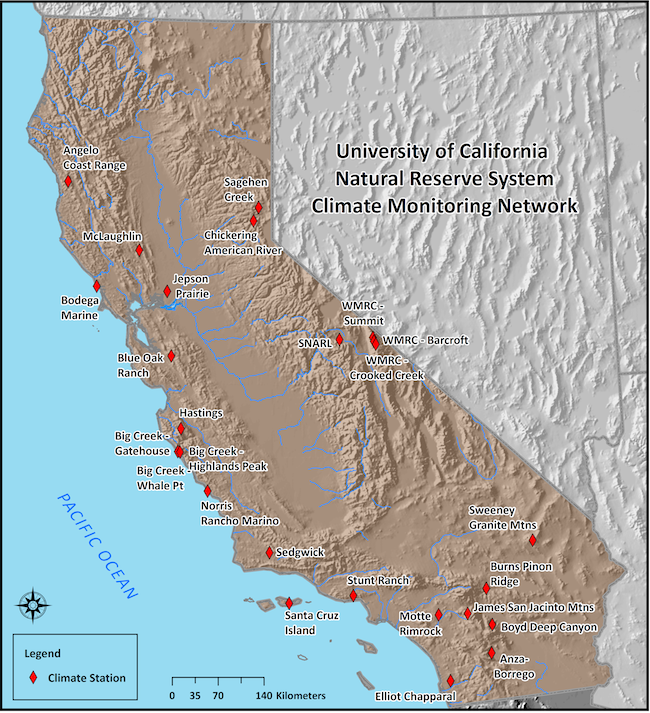
To access near real-time and historical data, click on the station of interest on the map or from the list on the right column:
|
Station list
UC Berkeley Bodega Marine Jepson Prairie McLaughlin
UCLA UC Irvine Burns Pinon Ridge Anza-Borrego
UC Riverside
Boyd Deep Canyon
James UC San Diego Elliott Chaparral UC Santa Barbara Rancho Marino Santa Cruz Island Sedgwick SNARL UC Santa Cruz Big Creek - Gatehouse Big Creek - Highlands Peak Big Creek - Whale Point Fort Ord Natural Reserve Younger Lagoon |